After my second daughter died, my husband and I were in
search of “the trip of a lifetime.” A
luxurious vacation didn’t seems appropriate - we wanted a more soulful and meaningful
trip to dedicate to our daughters. We
love hiking, camping, and the outdoors, so we decided on a challenging
adventure – to climb Mount Washington. We went the third week of August when we hoped for the best weather.
Mount Washington is the highest peak in the Northeastern
United States at 6,288 feet, located in New Hampshire. Below is a review of our trip.
Our Route:
Ascent:
Tuckerman Ravine Trail
Descent:
Crawford Path to
David Path to
Boott Spur Trail
Preparation & Gear
We took the climb seriously.
My husband, an Eagle Scout, has always lived up to the Boy Scouts motto,
“Be prepared” when spending time in the outdoors. We each had the 10 essentials in our packs, which I thought was totally ridiculous at first, but boy were we
close to needing them!
You can refill water at the summit, so bring enough for the
trip up.
We each had Black Diamond Trail Back Trekking Poles. For me, these poles were not a good fit for
this climb. It was easier to use all
fours to climb at points and the poles were a hindrance and
hard to collapse. I’d recommend easily
collapsible poles, for easy storage during steep climbing parts. Something like these.
We camped at the Dolly Copp Campground and drove to Pinkham Notch, where the trail head was. We were able to leave our car there for free all day.
When we returned from our hike in the evening, even though Pinkham Notch had closed, the showers (for pay) and bathrooms in the
basement were still available.
There is an option to pay for a shuttle down the
mountain. This is what most people did
as we saw many people on the trail on the ascend but almost no one making the
return trip down the mountain.
We had an amazing time hiking round-trip, but I am glad we
were prepared and took the climb seriously as far as supplies were
concerned. As you can imagine, with such
rocky terrain, the climb down was MUCH more strenuous than up. The trails are not that long, but they are
difficult.
 |
| Tuckerman Ravine Trail trail head |
The Climb Up
We chose to take the Tuckerman Ravine trail up the
mountain, as it is described as “one of the
shortest, most scenic, and most popular trails to the summit used by both
hikers and skiers.” Overall, the hike up
was amazing. We had great weather for 2/3 of the ascent - warm temperature and mostly sunny skies. The first half of the trip was very manageable. There were some nice waterfalls along the trail and beautiful wooded area.
 |
| Waterfall along the Tuckerman Ravine Trail |
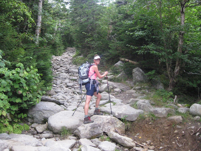 |
| The first half of the climb |
At the half-way mark, there was a beautiful view of Tuckerman Bowl. We were surprised and excited to learn we would be climbing it!
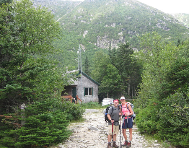 |
| Tuckerman Bowl view |
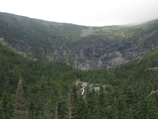 |
| The view of Tuckerman Bowl at the half-way mark. A beautiful waterfall in the distance. |
The second half of the climb was more strenuous. It was certainly more of a "climb" than a "hike," hence the word choice. We ascended Tuckerman Bowl, at this point, the terrain was starting to get more rocky. The views were gorgeous and it was so neat climbing next to the waterfalls.
 |
| Getting closer to Tuckerman Bowl |
 |
| Climbing Tuckerman Bowl |
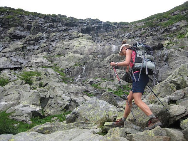 |
| In addition to the big waterfall, there were a lot of little falls |
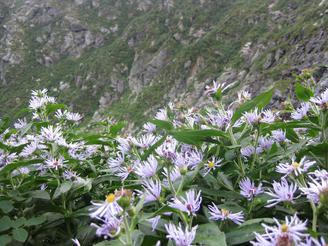 |
| There was not much vegetation above the tree line, except I saw these purple flowers, which I dubbed "Quinn's flowers." |
Once we got up Tuckerman Bowl, the rest of the climb was all boulders. Here, I struggled with my hiking poles and found it was easier to scramble on all fours at times and put my poles away. (My advice - bring poles that are easily collapsible!) This portion of the climb was a bit relentless as the weather was also starting to turn.
 |
| There were a lot of people ascending but no one descending! |
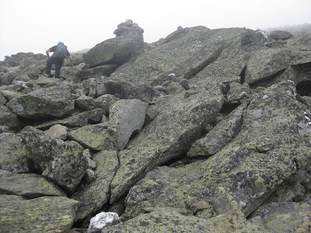 |
| The last leg of the ascent - two long boulder sections |
The Summit
We were thrilled when we reached the top! However, the wind was whipping at about 50 mph and the clouds prohibited any view. This is the view when the summit isn't in the clouds:
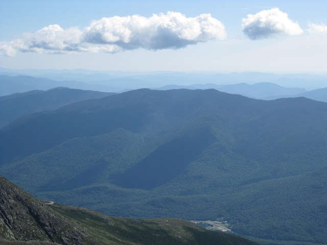 |
| The view from Mount Washington on a clear day |
 |
| The view from Mount Washington on a clear day |
However, the summit was in the clouds for us so we could barely see our own hand extended in front of us! But, it's ok because the journey is more fun than actually reaching the top!
 |
| Enjoying the summit in the clouds and wind |
We brought a rock that was engraved with a R (Riley - my living daughter) on one side and a Q (Quinn - my daughter who was stillborn) on the other side to leave at the top. We left it in the summit cairn with the R side down since Riley is still with us on this earth and the Q side up since Quinn's energy has been released into the universe.
 |
| The engraved Q and R rock that we left in the summit cairn |
 |
| We left an engraved rock for our two daughters in the summit cairn |
The Climb Down
We had such a wonderful experience on the climb up that we
decided to make a last minute change to our plans and descend down a different
trail, to more fully experience the mountain. We took Crawford Path to Davis Path to Boott Spur Trail. We hit the trail a little late in the morning, so we were a bit off schedule for our descent departure. However, we were still confident we were OK on daylight. Wrong! We hiked for 2 hours in the pitch dark!
Mount Washington has the reputation of being "home of the world's worst weather." Although we didn't have to worry about snow in late August, we got a sense of this with the brutal winds on the descent. Our descent was entirely unprotected for several hours. Do not follow this descent if there is any chance of lightening.
Crawford Path started with a rocky descent down boulders but then quickly became a bit less steep. There were supposed to be beautiful views, although the clouds prohibited us from enjoying them.
 |
| Crawford Path in the clouds |
 |
| Crawford Path in the clouds |
Once on Davis Path, we walked along a ridge for a while, which was rocky but very flat. The strong wind knocked me over at times!
 |
| Davis Path |
 |
| Davis Path |
Time was flying by and when we hit Boott Spur Trail, we started to get nervous about daylight. A good while into Boott Spur, we finally hit the tree line which gave us a break from the howling winds. My big rookie mistake was the trail choice. I learned, that if it is cloudy and extremely windy at the summit, it will probably be like this on a long exposed trail like Crawford-Davis-Boott Spur. In our weather conditions, I think it would have been better to descend Tuckerman's Ravine. Nonetheless, even though the wind challenged our hike and we didn't have views, it was still amazing. It felt more like Mars than Earth, which was really neat.
We only saw two other couples on the descent, and we were the last ones on the trail by several hours. It became dark at 7:30pm and we hiked the remaining two hours in the dark. Thank goodness we each had the 10 essentials, which includes headlamps. If we had no headlamps, or only one, it would have been a mess.
Hiking in the dark had it's challenges. It was still steep and it was harder to navigate the rocks. We got a little nervous when we saw a "Caution - Trail Under Construction" sign. It would not have been possible to turn back and take a different trail at this point, the other junctions were too far away. It turned out OK - the sign was referring to a ladder that we were able to clumsily bypass and slide down the ledge instead.
I did see bear scat and as we didn't have a bear bell, I took it upon myself to sing songs for the duration of the descent, just to let the bears know we were there. My mantra was that I needed to get home safely to my living daughter Riley!
We reached Pinkham Notch at 9:30pm and were relieved we made it back safely. Had we been forced to backtrack if the construction was impassible or gotten injured, we very likely would have had to spend the night out there.
The whole journey was soulful and incredible. I learned a lot about myself and about life. Life is about the journey and you have to surrender to the situation at times. As much as you would like to change some things, you can't. Whether it be changing the situation of hiking Mount Washington in the dark or bringing Quinn back to life, events that we did not ask for happen to us and we have to embrace them in order to move forward. Resisting or fighting the reality does not change it.
I would climb Mount Washington again - in a heartbeat. Next time, though, I will not hit the trail late!


No comments:
Post a Comment